Brandywine Falls: 70 Metres, Fifteen Minutes, and a Gate That Closes for Winter
The Sea to Sky's other ten-minute waterfall stop, and the honest one - a 70-metre drop over a volcanic ledge, a covered bridge, and a lot that is gated all winter. Worth the pull-off if the gate is open. Not worth a ticket for parking on the highway if it is not.
·
Quick facts
- Distance
- 1.2 km
- Elevation gain
- 20 m
- Highest point
- 480 m
- Difficulty
- Easy
- Time needed
- 0.5-1 hour
- Route type
- Out and back
- Season
- May through October for the paved lot. The park is open year-round on foot, but BC Parks closes and does not plow the Highway 99 lot in winter, and vehicles left on the highway are towed.
- Drive from Vancouver
- 1 h 30 min
- Transit accessible
- No
- Dog friendly
- Yes
- Pass or permit
- No pass requiredNo day-use pass and no fee. Brandywine Falls Provincial Park is free. The constraint is the gate, not a ticket.
- Last hiked
- Traditional territory
- Sḵwx̱wú7mesh Úxwumixw (Squamish Nation) and Lil̓wat7úl (Lil'wat Nation) territory. Brandywine sits in the corridor both nations have used for millennia, between the Squamish valley and the Whistler-Pemberton basin.
On this page4 sections
Shannon Falls is the waterfall people stop for on the way to Squamish. Brandywine Falls is the one they skip because it is another twenty-five minutes up the highway and they assume they have already seen a waterfall today. That is a mistake if the gate is open.
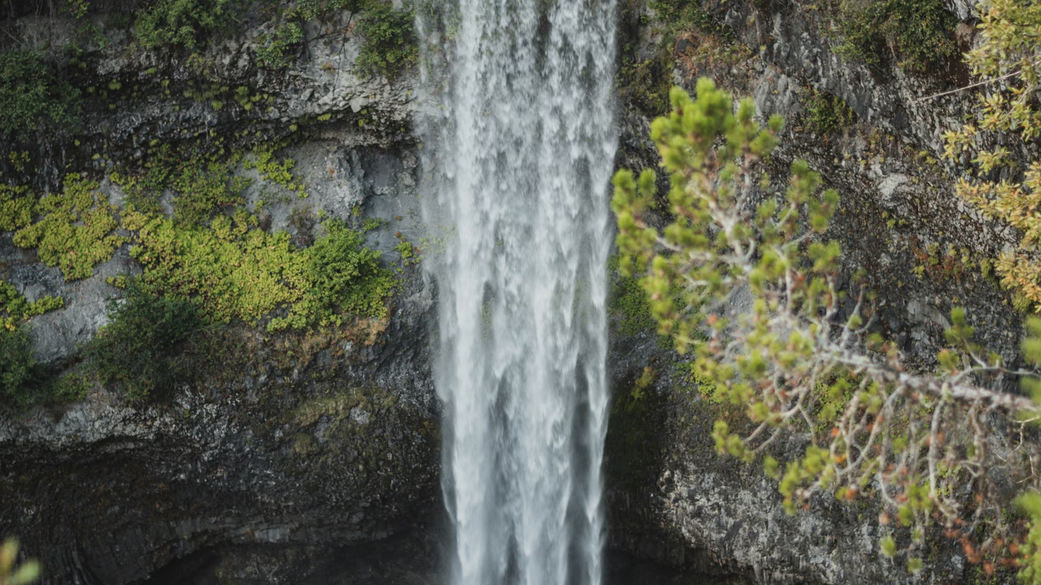
What you get: a covered wooden bridge over Brandywine Creek, a packed-gravel walk that is essentially flat, a rail crossing, and a platform on the lip of a volcanic escarpment looking at a 70-metre single drop. Most people are on the platform in ten or fifteen minutes. It is not a hike. It is a very good fifteen minutes.
Getting there
Highway 99, 47 km north of Squamish, signed in both directions. The lot is immediately off the highway. In the open season that is the entire access problem, aside from the lot filling on a July afternoon.
From November through April the problem changes. BC Parks closes the gate and does not plow the lot. The park itself stays open on foot. The highway does not become a parking lot. Vehicles left on 99 or in front of the gate are towed. If you want this in snow, plan a drop-off or start from the Whistler Bungee parking on Cal-Cheak Forest Service Road and walk the long way. Do not invent a shoulder.
The walk
Cross the covered bridge. Right for the falls, left for the Lava Lake Trail if you have time you will not use. The falls walk crosses the CN rail line - look both ways, trains are real here - then a short walk to the new platform.
Stay on it. The canyon below is the kind of drop that does not give you a second chance, and the rock is the same wet volcanic stuff that kills people at Shannon. There is a second short path to a Daisy Lake and Black Tusk view. Take it. The waterfall photograph is obligatory. The lake-and-Tusk photograph is the one that is actually of this place rather than of a waterfall that could be anywhere.
The photograph
A 70-metre fall in a tree-walled notch wants overcast and a vertical frame. The platform puts you slightly above the lip, looking down the column into a dark pool. Cedar in the foreground is free if you are patient. Climbing the fence for a cleaner angle is how this platform earns its warning signs.
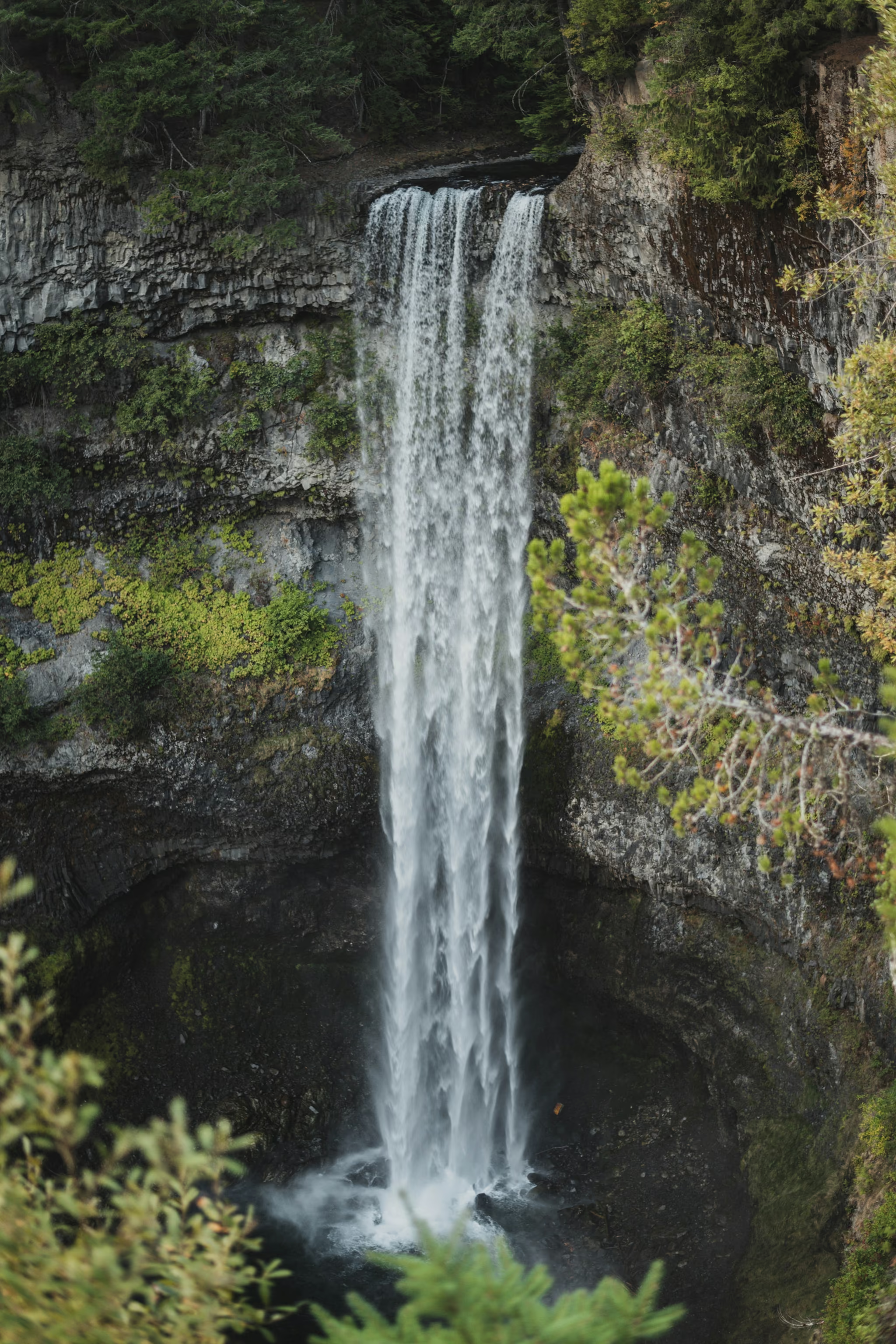
I photographed it on 16 October 2022, grey light, the column running well. That is the version in the pictures on this page. A dry August is a different waterfall.
If you have more than twenty minutes
The Lava Lake Trail is 2.7 km through pine forest that is unusual for this coast, and a 1.5 km piece of the Sea to Sky Trail heads toward the Whistler Bungee bridge. Both are the reason this park is not only a toilet stop. Neither is why most people pull off 99, and that is fine. The platform is enough, provided you did not drive here as a destination of its own from Vancouver. Pair it with Shannon, the Chief, or a Whistler day. Do not make 90 minutes of driving for 15 minutes of walking unless the light is perfect and you already know that.
Overcast, the column running as a single white drop from the railed platform. Gate was open. A dry August will not look like this.
Reported by Parveen Singh
My BC trail kit and A7 IV settings
What is in my bag on a BC hike and why, plus the A7 IV settings I start from for each kind of scene. Confirm your email and it lands in your inbox, then one letter a month after the hike.
By signing up you agree to receive emails from psingh.ca. One letter a month, and you can unsubscribe any time.
Shooting this trail
Photography notes
- Best light
- Overcast, same as every other Sea to Sky waterfall. The platform looks across a dark volcanic notch, so hard sun blows the water and kills the rock. A grey day is the correct day. Late afternoon can put a little side light on the cliff if you insist on sun, but the photograph that looks like this place is the flat one.
- Best season
- May and June for snowmelt volume, October for wet rock and fewer buses. August is the thin-white-thread version of Shannon Falls, just 70 metres instead of 335.
- Compositions
- The full drop as a vertical from the main platform at 24-35mm, with a cedar branch in the foreground if you can do it without climbing the fence. This is the postcard and it is the postcard for a reason.
- A second, shorter walk to the Daisy Lake and Black Tusk viewpoint. That frame is the one that is not just another waterfall, and most people turn around before they get it.
- Long exposure 1/2 second to 1 second. Faster and the column looks lumpy. Much slower and you lose the edges that make a 70-metre fall look tall rather than like fog.
- Gear
- Polariser over ND. Wet basalt goes grey without it. The platform is stable enough for a tripod if you wait for a gap in foot traffic. Stay behind the fence. BC Parks is explicit about the canyon below, and the lower falls area is closed for a reason. Drones are prohibited in the provincial park.