Tunnel Bluffs: The Howe Sound Viewpoint With a Parking Problem
The finest sunset bluff on Howe Sound, guarded by the most aggressively enforced parking situation in the Lower Mainland. Solve the parking and the hike is straightforward. I was back on 16 August 2026 and that still holds.
·
Quick facts
- Distance
- 11.5 km
- Elevation gain
- 470 m
- Highest point
- 600 m
- Difficulty
- Moderate
- Time needed
- 4-5 hours
- Route type
- Out and back
- Season
- May to November. The bluff itself is low enough to clear early, but the approach holds snow into spring and the creek crossing runs high and unpleasant during the peak melt.
- Drive from Vancouver
- 35 min
- Transit accessible
- Yes
- Dog friendly
- Yes
- Pass or permit
- Fee requiredNo trail permit or park pass. The fee is parking: the Sunset trailhead lot in Lions Bay is pay parking at $3 per hour up to $24 per day, with a three-day maximum, paid via the PayByPhone app, website, or 1-888-680-7275. Resident and annual permit holders park free in permit and pay zones. Everyone else pays.
- Last hiked
- Traditional territory
- Sḵwx̱wú7mesh Úxwumixw (Squamish Nation) and səlilwətaɬ (Tsleil-Waututh) territory
Recent conditions
Dated observations from the trail. Always check current official sources before you go.
Hiked it myself Trail dry and dusty to the bluff. The two-log creek crossing was low and trivial. No snow. Clear sunset with a light marine haze on the far shore, no inversion. Sunset around 8:20pm, headlamp on for the whole descent.
Gear used
- headlamp
- tripod
Reported by Parveen Singh
On this page5 sections
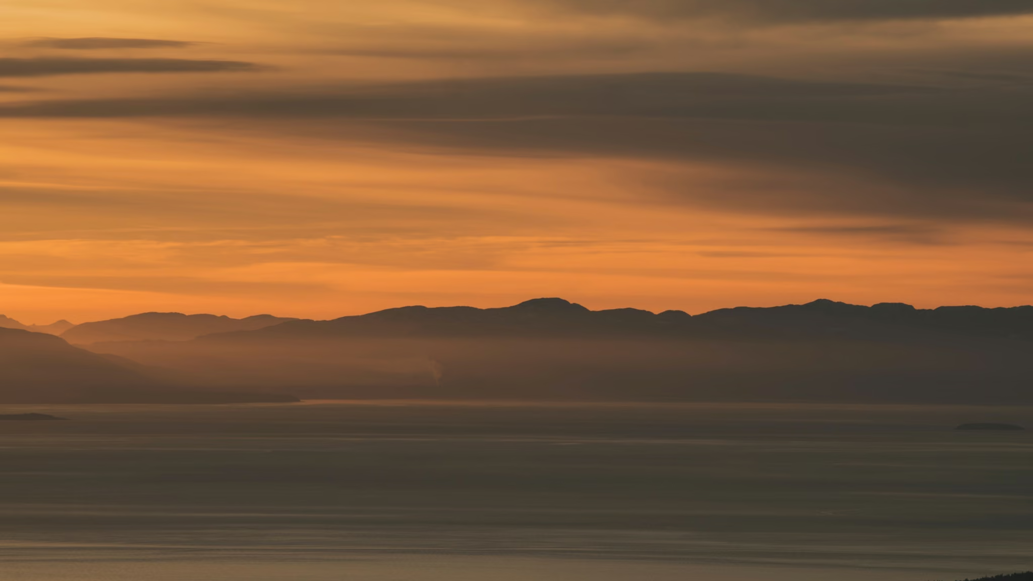
I went back to Tunnel Bluffs on 16 August 2026. Same 11.5 km, same 470 metres of gain, same granite bench about 600 metres directly above Howe Sound. The photograph at the top of this page is from that evening.
The hike is still the easy part. The parking is still the thing that will wreck the day if you treat Lions Bay like a provincial park lot.
The Lions Bay parking situation
Lions Bay is a small municipality of a few hundred homes on a steep hillside with narrow roads, and it sits at the trailhead for several of the most popular hikes in southwest BC. The village has responded with a parking regime that is strict, well signed, actively enforced, and expensive to get wrong. None of it will be waived because you did not know.
What costs money and is legal. The Sunset trailhead lot has roughly 18 pay stalls at $3 per hour up to $24 per day, with a three-day maximum. Payment is through the PayByPhone app or website, or by calling 1-888-680-7275. Eighteen stalls against the demand this trailhead generates means it fills very early. On a clear summer Saturday, treat 7am as realistic and 8am as late.
What is permit-only. Most streets below Highway 99 in Lions Bay are restricted to annual resident parking permits. Residents and annual permit holders park free in permit zones and pay zones. If you do not hold a permit, those streets are not available to you regardless of how much empty curb you see. Enforcement runs seven days a week and the penalties are set deliberately high to discourage exactly this.
What no longer works. For years the standard approach to Tunnel Bluffs was the Tunnel Point pullout directly on Highway 99. That ended in March 2020 when 30-minute parking restrictions were imposed, and vehicles left there have been ticketed and towed since. Any guide, forum post or map still directing you to Tunnel Point is out of date.
Legal overflow. Designated stalls near the elementary school down the hill along Bayview Road. Use the marked stalls only, not the road edge beside them, which is permit-only, and accept a steep extra 1 km each way, uphill on the return when you are already tired.
Last resort. Free provincial parking at the Highway 99 northbound interchange at Brunswick Beach. A longer road walk, but free and legal.
16 August, mid-afternoon. I did not try to beat the morning rush. I arrived for a sunset hike and the Sunset lot was already full, as it will be on any decent August weekend if you show up after lunch. I used the marked stalls by the school, walked the extra kilometre up, and paid for the legal option. That is the whole sunset version of this trail: you will almost never get a stall at the trailhead if you time the hike for the light. Budget the school walk, or take the 262.
The option most people ignore. TransLink route 262 serves Lions Bay, with about a 1.6 km walk from the stop to the trailhead. It is limited service rather than frequent, so plan around the timetable in both directions and check it the night before. It removes the parking problem entirely. If you intend to shoot the bluff at blue hour, check whether the last 262 still runs before you assume it does. On this visit I drove, because the last bus did not line up with a walk-out after 9pm.
The hike
The route combines a service road, an old logging road and singletrack, climbing steadily rather than steeply. 470 metres over 5.75 kilometres each way is a gentle average and the trail delivers on that - no sustained brutal section, no scrambling. A reasonably fit person in decent boots will find it comfortably manageable.
The feature to know about is the creek crossing: two logs. In August it was a non-event. The water was low, the logs were dry, and I crossed without thinking about it. During peak snowmelt in May and early June it runs higher, the logs are wet, and it becomes the crux of the day. It is also the reason the dog answer below is complicated.
The upper trail has rocky sections and roots, and the final approach opens onto granite. Nothing technical, but it is the kind of ground where a rolled ankle happens on the descent when you are tired and the light is going. Allow four hours moving steadily, five if you stop properly at the top. Add a full descent in darkness if you are staying for sunset. On 16 August that was a headlamp walk from the bluff to the car, and it felt as long as it sounds.
The bluff
It is worth it. The bluff is open granite with the Sound falling away 600 metres below, Bowen Island across the water, the headlands stacking south toward Vancouver, and enough space to spread out even when there are other people up there.
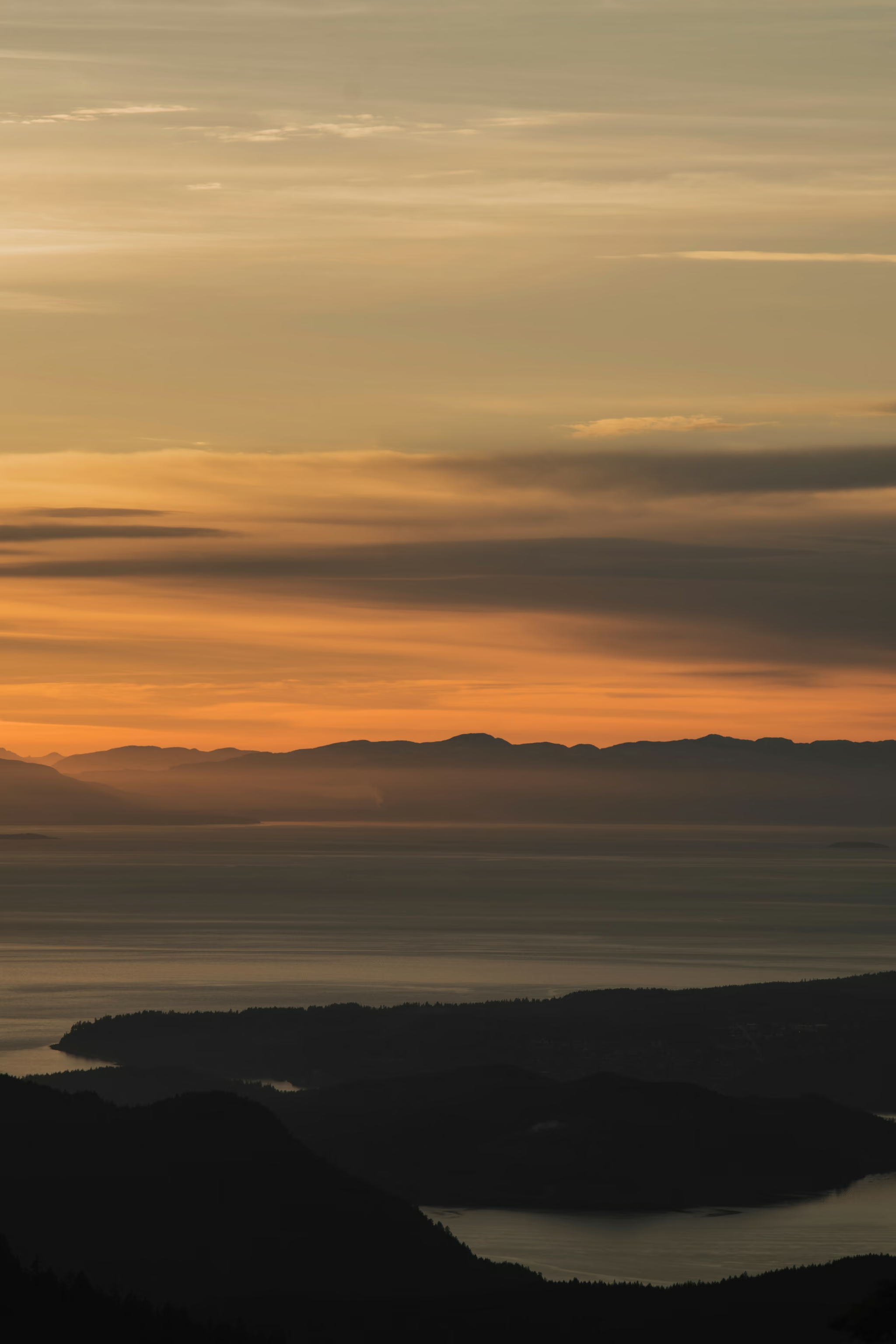
On 16 August the marine layer stayed off the water. The sun dropped into a colour band above the far ridges, the Sound went to a thin bright strip, and the near forest went black. I shot the frame that is now the hero of this page from that ledge, then stayed into blue hour while the far shore lights came up. That is the version of Tunnel Bluffs I keep coming back for.
Dogs
Dogs are permitted and the trail suits them for most of its length. Two genuine caveats. The two-log creek crossing is difficult or impossible for some dogs, particularly smaller ones or dogs uncertain on narrow footing, and you should plan to lift or carry rather than coax. In August the crossing is easier, but the logs are still logs. And the cliffs at the bluff are unforgiving, so leash up before the trail opens onto the rock rather than after.
Season and conditions
May through November. The bluff is only at 600 metres so it clears relatively early, but the approach holds snow later than the elevation suggests and the creek runs hard through the melt. September and October are the most pleasant months to walk it, with the trade-off that the sunset moves south behind the near ridge.
Mid-August is dry trail, low creek, and a sunset that is still far enough north to land down the Sound. It is also dusty, warm on the climb, and cold on the bluff the moment the sun goes. Bring a layer you will actually put on.
Two things to check before committing: the creek level after a warm spell or heavy rain, and the marine layer forecast for Howe Sound. Low cloud sitting on the water is common and turns the signature view into a wall of grey - though it occasionally does the opposite and puts you above an inversion, which is the best version of this bluff there is. On 16 August the Sound stayed clear. That is not a promise about your day.
Trail notes from the field
One email a month: what is melting out, what is snowed in, and where the light is good right now. Written after the hike, not before it.
By subscribing you agree to receive occasional emails from psingh.ca. No spam, no selling your address, unsubscribe any time.
Shooting this trail
Photography notes
- Best light
- Sunset, and this is one of the few places where that is not a default recommendation but the entire reason to come. The bluff sits about 600 m directly above Howe Sound facing west and southwest, so the sun drops into the water in front of you with Bowen Island and the Sound's headlands stacked below. From late April through August the sun sets far enough north that it lands well down the Sound rather than behind the near ridge, and that is the window you want. On 16 August 2026 sunset was around 8:20pm, which is already kinder than midsummer, and I was still walking out under a headlamp for the full 5.75 km. Blue hour, roughly 25 to 40 minutes after the sun goes, is when the water turns steel and the lights of the far shore come up, and it is better than the sunset itself.
- Best season
- May through August for the northern sunset position. September and October give sharper air and better cloud but the sun sets behind the closer ridge line, which is a different and less dramatic photograph. Mid-August is the compromise I keep choosing: dry trail, still-northern sun, and a descent that is long but not a 9pm start.
- Compositions
- The signature frame at 20-35mm from the bluff edge: a foreground of textured granite and stunted juniper, the Sound falling away, and the islands layered into the sun. Get the camera low so the granite occupies the bottom third with real texture - shot from standing height this becomes a generic ocean view.
- Telephoto compression at 100-200mm down the length of Howe Sound as the sun sets. Headlands stack into flat tonal bands and any ferry or freighter crossing the frame gives you scale and a subject. This is the strongest image most people come away with and it requires patience rather than a better position.
- A silhouetted ridge-and-water stack against the colour band, with the near forest as a dark base. That is the 16 August frame: portrait, sky-heavy, the Sound as a thin bright strip between silhouettes. Expose for the sky and let the land go black.
- Blue hour long exposure at 30 seconds or more, with the Sound smoothing to a flat sheet and the far shore lights as points. This is where the tripod earns its weight and where most people have already left.
- Gear
- A tripod and a headlamp are both non-negotiable if you are shooting sunset, because the descent is nearly 6 km through forest and it will be fully dark. I used both on 16 August and would not go without a spare lamp or a charged phone as backup. A graduated ND or exposure bracketing handles the range between a lit sky and a shadowed bluff. The bluff is open granite and catches wind straight off the water, so weight the tripod with your pack for anything over a second. Warm layers matter more than the daytime temperature suggests - an exposed west-facing bluff at 600 m loses heat fast once the sun is down. Drone rules here are not officially posted; this is outside a provincial park boundary but the airspace is near a busy corridor, so treat it as unverified rather than open.