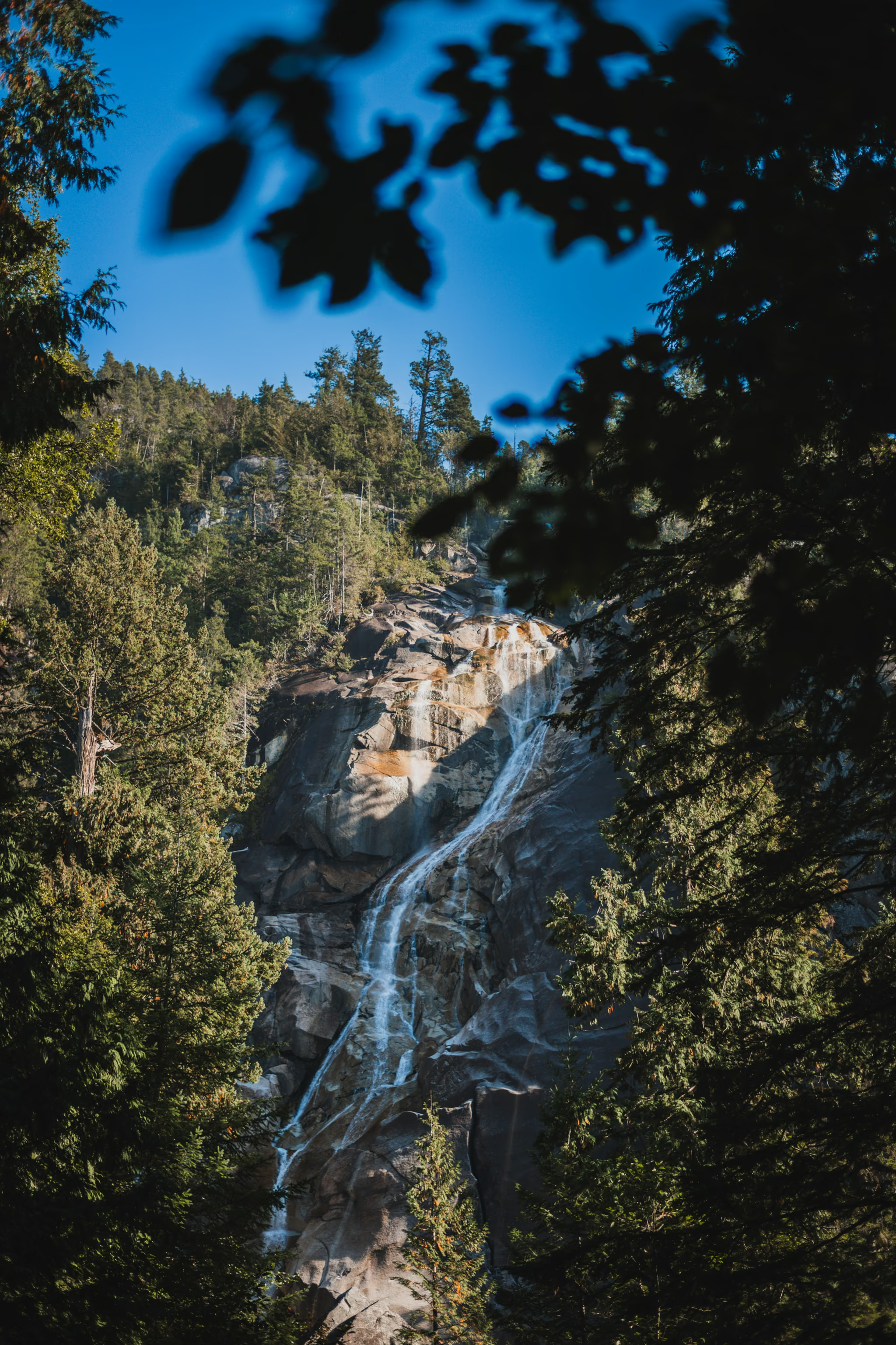
Shannon Falls: A 10-Minute Walk to BC's Third-Highest Waterfall
Not a hike, and nobody should pretend otherwise - but a 335 m waterfall ten minutes from your car is a fair trade for the parking-lot chaos, and the connector to the Chief is the real reason to park here.
Quick facts
- Distance
- 1 km
- Elevation gain
- 45 m
- Highest point
- 100 m
- Difficulty
- Easy
- Time needed
- 0.5-1 hour
- Route type
- Out and back
- Season
- Year-round. The falls run hardest during the May and June snowmelt and after autumn rain; the boardwalks and stair treads get genuinely slippery from November through March.
- Drive from Vancouver
- 1 h
- Transit accessible
- No
- Dog friendly
- Yes
- Pass or permit
- No pass requiredNo fee and no day-use pass to enter Shannon Falls Provincial Park or to walk the falls trail. The only place money enters the picture is the Sea to Sky Gondola, which is a separate private operation: a one-way Ride Down Only ticket for hikers coming up the Sea to Summit Trail was $19 online and $25 at the window in the 2026 season, and a round-trip adult sightseeing pass was $73.95 online.
- Last hiked
- Traditional territory
- Sḵwx̱wú7mesh Úxwumixw (Squamish Nation) territory
On this page5 sections
Let me be direct about what this is, because a lot of write-ups are not. Shannon Falls is a 1 km round trip on packed gravel, boardwalk and stairs, gaining about 45 metres, ending at two railed viewing platforms beneath a waterfall. It takes most people twenty-five minutes including photographs. It is not a hike. It is a very good roadside attraction with a short walk attached.
That is not a criticism. At 335 metres it is the third-highest waterfall in British Columbia, behind Della Falls on Vancouver Island and Hunlen Falls in Tweedsmuir, and it is two minutes off Highway 99. Nowhere else in the province gives you a waterfall of that scale for that little effort. If you are driving to Squamish or Whistler anyway, stopping is the correct decision.
Is the viewing platform alone worth it?
Yes, with one condition attached: the volume of water varies enormously through the year, and so does the experience.
In late May and early June, when the snowpack above is dumping, the falls are loud enough that you cannot hold a conversation at the lower platform and you will get wet standing there. That is the version worth driving for. By late August in a dry year the same falls can be reduced to a thin white thread down a very large rock face, and people who show up then leave visibly disappointed. After a heavy autumn rain it comes back.
The upper viewpoint is a short additional climb of stairs and gives you a slightly different angle plus a bit more of the surrounding forest. It takes an extra five minutes. Do it, but do not expect a revelation.
The crowding, honestly
This is the busiest trail in the corridor and there is no version of this guide that softens that. Between roughly 10am and 4pm on any summer weekend, the parking lot is at capacity, the boardwalk is a slow-moving queue, and the lower platform has a rotating crowd of people taking the same photograph. The trail is short and paved precisely because it is built to absorb that traffic, and it does absorb it, but you are not going to have a quiet moment with a waterfall.
The fix is trivially simple and almost nobody does it: come before 9am or after 5pm. In midsummer there is good light until well past 8pm, the lot is half empty, and the same walk becomes genuinely pleasant. A weekday in October at 4pm is better still.
The connector to the Chief and the Sea to Summit Trail
This is the part that changes Shannon Falls from a photo stop into something useful, and it is under-advertised.
A connector trail runs south from Shannon Falls Provincial Park through the forest to the Stawamus Chief trailhead. It is short, it is well-built, and it means you can park in one place and do both. Practically, this matters most in reverse: the Chief lots are larger and have overflow lots north of the main lot on both sides of the highway, joined by a pedestrian overpass. When Shannon Falls is full at 11am on a Saturday, park at the Chief, walk the connector north to the falls, then walk back and go up the Chief. You have solved the parking problem and added maybe twenty minutes of walking.
The same corridor also feeds the Sea to Summit Trail, which climbs about 7.5 km and roughly 918 metres from the base area up to the Sea to Sky Gondola summit lodge. It is a genuine intermediate hike, three and a half hours or so for most people, and the standard way to finish it is to buy a one-way Ride Down Only gondola ticket rather than descend on foot. In the 2026 season that download ticket was $19 online, $25 at the window. Hikers starting from overflow parking use the Shannon Falls Connector to reach the Sea to Summit trailhead, which is why the connector exists in the first place.
So the honest recommendation: do not drive to Shannon Falls as a destination. Drive to the corridor, park once, and treat the falls as the first ten minutes of a bigger day.
Squamish significance
Shannon Falls sits in Sḵwx̱wú7mesh Úxwumixw (Squamish Nation) territory, and the falls hold spiritual significance for the Nation. The traditional account associated with this place tells of Say-noth-ka, a two-headed sea serpent living in and around Howe Sound, whose repeated movement up the mountainside carved the channel the water now falls through.
Practical details
Dogs are allowed and must be leashed at all times, and they are not permitted in the day-use beach or building areas. The trail surface is fine for a dog, though on a busy day a nervous dog will have a bad time in the crowd.
There is a day-use picnic area with tables, washrooms, and in summer a concession. The trail is short enough and graded enough that it works with small children and mostly works with strollers, though the stairs to the upper viewpoint do not.
In winter the park stays open but services are reduced, the stair treads and wooden walkways get slick, and after a cold snap parts of the spray zone ice over. It is still walkable; just take it slowly and do not count on grip.
Reported by
Trail notes from the field
One email a month: what is melting out, what is snowed in, and where the light is good right now. Written after the hike, not before it.
By subscribing you agree to receive occasional emails from psingh.ca. No spam, no selling your address, unsubscribe any time.
Shooting this trail
Photography notes
- Best light
- Overcast, and it is not close. Shannon Falls sits in a steep, tree-walled amphitheatre facing roughly west, which means on a clear summer afternoon you get blown-out white water against black forest and nothing in between - a contrast range no sensor handles. A flat grey sky is the correct light here, and light rain is better still because the wet rock saturates. If you can only come on a bright day, go early: until about 9:30am in midsummer the amphitheatre is still in full shade while the sky above is lit, and that is the one workable window.
- Best season
- Late May and early June for peak snowmelt volume; late October and November for high water plus wet, saturated rock and moss.
- Compositions
- The full-drop vertical from the lower platform at 16-24mm. This is the obvious shot and it is obvious for a reason, but you must shoot it in portrait orientation - 335 m of waterfall does not fit a landscape frame and cropping down to it later throws away most of your pixels.
- Long exposure of the lower cascade: 1/2 second to 2 seconds is the useful band. Faster than about 1/4 second and the water reads as frozen and lumpy; slower than 3 or 4 seconds and it turns into a featureless white smear with no internal structure. A 6-stop ND is the single most useful filter to carry here, and on a properly overcast day at f/11 and ISO 100 you can often reach 1/2 second with no filter at all.
- Isolate one chute at 70-200mm. The falls break into several distinct ribbons on the way down and a tight crop on one of them, shot at 1/15 to 1/8 second, gives you far more texture than the wide shot ever does. This is the frame most people walk past.
- Turn around. The mossy boulder field and the big-leaf maples on the walk in photograph better than the falls on a bright day, and a 35-50mm frame of wet moss and trunk with the falls softly out of focus behind is a more honest picture of what the place feels like than the postcard.
- Gear
- A polariser matters more than the ND here - wet granite and wet leaves throw a lot of specular glare, and killing it is what makes the rock read black rather than grey. Bring a microfibre cloth and accept you will use it between every single frame at the lower platform, because the spray is constant and it lands on the front element within seconds. A tripod is required for anything below 1/60 second, and the lower platform is a boardwalk that flexes when people walk past, so trigger with a timer or remote and wait for a gap in the foot traffic. Drones are prohibited: this is a provincial park.