Cascade Falls, Mission: A 30-Metre Drop and a Suspension Bridge
The Fraser Valley's honest short waterfall stop - twenty minutes of stairs, a suspension bridge that is the photograph, and a 30-metre drop. Worth the drive when the creek is up. Stay on the designated trail.
·
Quick facts
- Distance
- 2 km
- Elevation gain
- 40 m
- Highest point
- 180 m
- Difficulty
- Easy
- Time needed
- 0.5-1 hour
- Route type
- Out and back
- Season
- Year-round at this elevation, with the volume tracking recent rain rather than a snowpack. November through June is the loud version. Late August is often a thin white thread and not a reason to drive ninety minutes.
- Drive from Vancouver
- 1 h 30 min
- Transit accessible
- No
- Dog friendly
- Yes
- Pass or permit
- No pass requiredNo fee, no pass, no reservation. This is a Fraser Valley Regional District park, not a provincial park and not a municipal one, so there is no BC Parks day-use pass and no gate. Park hours are 7am to sunset. The picnic shelter is first-come.
- Last hiked
- Traditional territory
- S'ólh Téméxw, the traditional and unceded territory of the Stó:lō peoples. Cascade Falls sits in the Hatzic Valley near Deroche, in Leq'á:mel territory, within the wider shared Stó:lō landscape that includes Sq'éwlets and Kwantlen
On this page5 sections
The waterfall people mean when they say Cascade Falls near Mission is this one: a Fraser Valley Regional District park at the end of Ridgeview Road in Deroche, a 30-metre drop, and a suspension bridge across Cascade Creek. It is not Bosumarne Falls. It is not a provincial park. And it is not a hike in any honest sense of the word.
What it is: about two kilometres return, forty metres of gain, a set of wooden stairs through coniferous forest, two viewing platforms, and a picnic shelter at a free lot. Most people are on the bridge within fifteen minutes of leaving the car. That is the whole outing, and it is enough, provided the creek is actually running.
Getting there
From Vancouver, Highway 7 through Mission, then east. Turn left onto Sylvester Road - there is usually a Cascade Falls sign just before the junction - and follow it about 15 km through the Hatzic Valley. Right on Ridgeview Road. The lot is at the end, 36421 Ridgeview Road.
The drive is the long part. Ninety minutes from Vancouver on a clean run, more if the Lougheed is slow, which it often is. There is no useful transit. Treat this as a car trip, or as a stop you make because you are already out this way for Steelhead Falls or the Hunter Trail, not as a destination you fight Highway 7 for on its own.
The lot is free, small, and honest about it. Pit toilets, a picnic shelter on a first-come basis, a map board, a yellow gate. On a Saturday after rain it fills. There is no signed overflow, so if the lot is full the honest options are wait, leave, or come back later. Parking on Ridgeview itself is a poor idea.
Park hours are 7am to sunset. Plan the return accordingly. This is not a blue-hour location.
The walk
From the lot, walk past the yellow gate. The trail you want peels into the trees on the right and starts climbing almost immediately. Wooden stairs do most of the work - on the order of fifty treads, not a staircase you need to train for. In a few minutes you are under the suspension bridge looking at the first view of the drop.
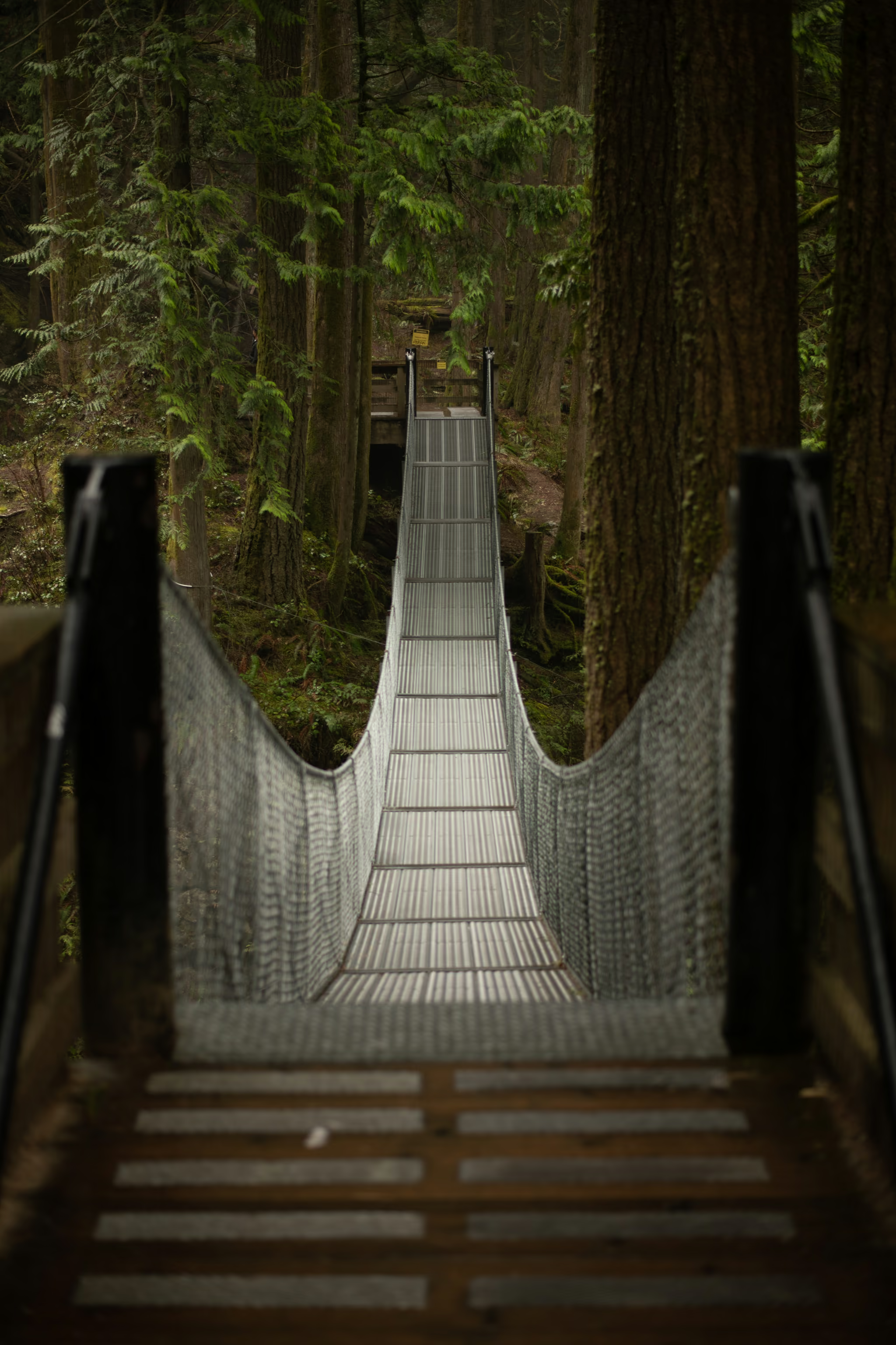
The lower platform is as close as the designated trail puts you to the water. When the creek is up you will feel spray. Cross the bridge for the second platform on the far side. From there you look down the 30-metre fall into the pool, rock walls on both sides, forest on the rim. That is the other photograph this park is for. The one on this page is the span itself.
FVRD also notes a smaller run of waterfalls dropping about 18 metres into lower pools. Stay on the signed trails to see what you can of them. The interesting water is the main drop from the bridge.
If you have a stroller, or you do not want the stairs, the wide gravel road past the gate still reaches the falls. It is longer and less of a walk in the forest. It is also how this park stays usable for people who would be stopped by the staircase on every other waterfall trail in this valley.
The photograph
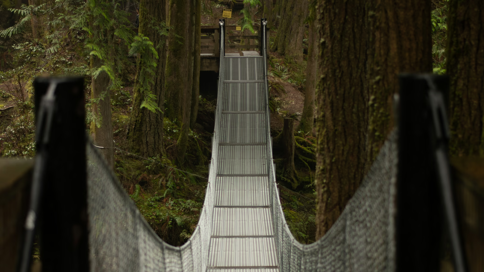
The frame on this page is the suspension bridge in flat light: metal deck, mesh rails, cedar on both sides. It is the one photograph that is actually of this park and not of a different waterfall with a similar name.
A 30-metre fall does not need 24mm. Wide from the bridge gives you a lot of trees and a white line. The 70-105mm end of the zoom, or a crop, is what makes the water and the wet rock fill the frame. A quarter-second to one-second exposure is the useful band. Faster looks frozen. Much slower and the notch disappears into a smear.
The drop from the deck is still the other frame worth taking. Cable, deck, cedar, water behind. Steelhead Falls has a wooden platform and no span. Bosumarne has no infrastructure at all. This is the one Mission-area waterfall with a structure in the picture that is not just a railing.
Dogs, kids, and what this is not
Dogs are allowed. Leash them on the stairs and on the bridge. The deck is a poor place for a startled pull.
Kids handle this if they handle stairs. The trail is short, the destination is obvious, and the fences exist. The reason I have still written a danger note is the off-trail ground, not the walk itself. Do not treat the creek edge as a swimming spot. It is not, and the park does not pretend it is.
What this is not: a substitute for Crooked Falls, Shannon Falls, or a day in the alpine. It is a twenty-minute walk to a real waterfall at the end of a long valley drive. Pair it with Steelhead Falls on the same Mission loop if you want the drive to do more than one thing. If you were looking for the unsigned waterfall up Chilliwack Lake Road, that is Bosumarne Falls, and it has no lot and no bridge.
Season
Low elevation, paved access to the lot, snow almost never the problem. Volume is. Cascade Creek is rain-fed. Two days of Mission rain and the bridge throws spray. A dry August and you have driven ninety minutes for a ribbon. November through June is when I would bother. Winter is fine if you want it, with the usual caveat that wooden stairs ice before the parking lot does.
Overcast, creek up, spray on the bridge. Walked the stairs, both platforms, and the span. Stay on the designated trail.
Reported by Parveen Singh
My BC trail kit and A7 IV settings
What is in my bag on a BC hike and why, plus the A7 IV settings I start from for each kind of scene. Confirm your email and it lands in your inbox, then one letter a month after the hike.
By signing up you agree to receive emails from psingh.ca. One letter a month, and you can unsubscribe any time.
Shooting this trail
Photography notes
- Best light
- Overcast, and ideally overcast after rain. The falls sit in a tree-walled notch, so a clear midday puts hard sun on white water against black rock, which is the one condition no raw file saves. A flat grey Fraser Valley sky is the correct light for the drop. The photograph on this page is the bridge: cedar, cables, deck. Same grey day.
- Best season
- November through June, when Cascade Creek is loud. Late May after a wet week is the version that throws spray onto the bridge. A dry August is a thin ribbon and a long drive for it. Cedar holds colour year round; do not wait for autumn foliage that is not the point of this park.
- Compositions
- From the suspension bridge looking down the main drop at 24-35mm. Get the rock walls in both sides and let the white water sit in the centre. This is the frame the bridge exists to give you, and you cannot get it from the lower trail without leaving the designated area, which you should not do.
- Tight vertical on the chute at 50-85mm, still from the platform. A 30-metre waterfall shot wide becomes a postcard of trees with a white line in it. Crop until the water and the wet rock are the whole picture.
- Long exposure between 1/4 and 1 second. Faster than that and the water looks frozen and lumpy. Past about two seconds the chute turns into a featureless smear and you lose the notch that makes this fall look like itself. The platform is a stable place for a tripod, which is not true of most Fraser Valley waterfall viewpoints.
- The bridge itself as a subject: cedar, deck, cable, and the drop behind. 35mm from one end looking across. It is the one photograph of this park that is not just another waterfall, and it is the thing Bosumarne and Steelhead cannot give you.
- Gear
- Polariser first. Wet rock and wet cedar throw a grey sheen, and killing it is what makes the notch go dark and the water stay bright. It also costs you about a stop and a half toward a usable shutter speed. The ND covers the rest on a bright overcast day. Bring a cloth. Spray reaches the bridge when the creek is up. The deck flexes when people walk past, so a two-second timer and a pause in the foot traffic is the difference between a sharp frame and a soft one. Do not climb the railing for a better angle. FVRD is explicit about that, and the record behind the warning is not theoretical.