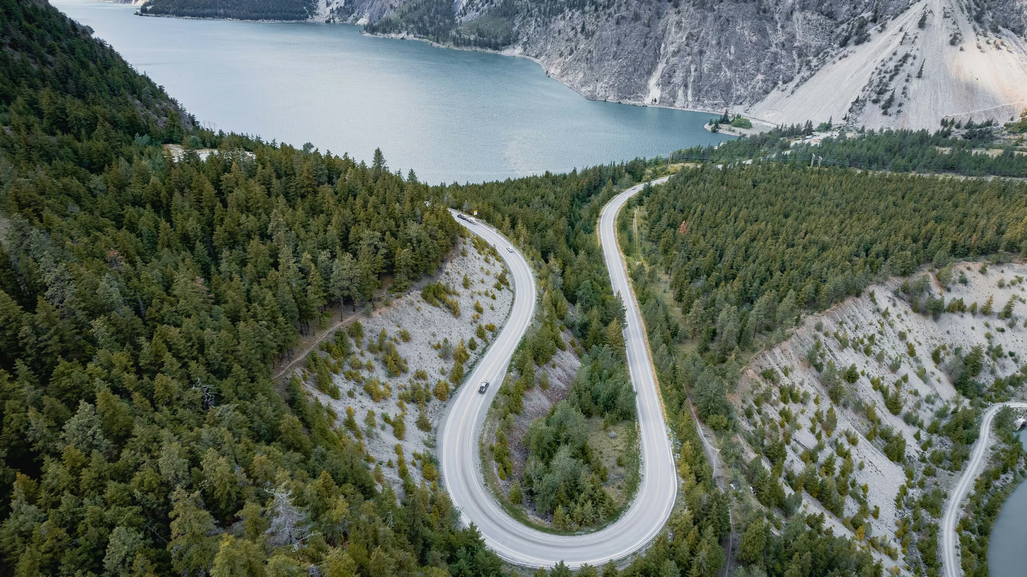
Seton Lake Lookout: The Hairpin Above the Turquoise
The Duffey stop people mean when they say they photographed Seton. A few minutes from the car to a bluff over the hairpin. Worth the four-hour drive only if you were already going to Lillooet or Joffre. Not a trail around the lake.
·
Quick facts
- Distance
- 1 km
- Elevation gain
- 40 m
- Highest point
- 540 m
- Difficulty
- Easy
- Time needed
- 0.25-1 hour
- Route type
- Out and back
- Season
- May through October for a clean highway and a lake that is actually that colour. I photographed the hairpin from above on 29 December 2023, which is a different road: ice, short days, and a Duffey you check on DriveBC before you leave Pemberton.
- Drive from Vancouver
- 4 h
- Transit accessible
- No
- Dog friendly
- Yes
- Pass or permit
- No pass requiredNo park pass. This is a highway pullout on Highway 99, not a provincial park trailhead. Winter tire and chain rules still apply on the Duffey from 1 October to 30 April. There is no ticket booth and no toilet you should count on.
- Last hiked
- Traditional territory
- St'át'imc territory, including Tsal'alh (Seton Lake Band). Seton Lake is a living lake with a hydro history and a community at Shalalth on the far shore, not an empty turquoise backdrop.
On this page3 sections
Seton Lake is the colour people mean when they say the Duffey was worth it even if they never put boots on. The hike, such as it is, is a short walk from a Highway 99 pullout to the bluff that looks down on the hairpin. You do not circuit the lake. You do not need a map. You need the vehicle out of the lane, and you need to treat a mountain highway as a mountain highway.
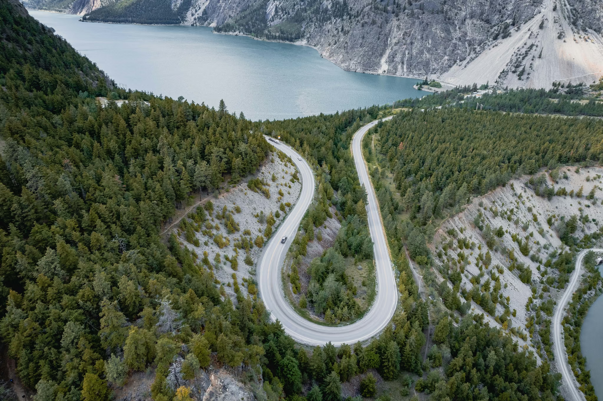
I photographed it from above on 29 December 2023. Overcast, the lake still holding colour, three vehicles on the bend for scale. That is this page. The roadside photo guide is the same stop from the railing. This page is the walk to the higher angle.
Getting there
Vancouver to Pemberton, then east on Highway 99 over Cayoosh Pass. The lookout sits on the Seton side, west of Lillooet. From Vancouver that is about four hours when the Duffey is behaving, and an abandoned day when it is not.
Winter tires in season. Check DriveBC from Vancouver, not from the Joffre lot with no signal. If you wanted frozen turquoise under a glacier, that is Joffre Lakes in winter, with avalanche terrain attached. This is a highway viewpoint.
The walk
Park in the pullout. Walk toward the drop, not toward the travel lane. The unofficial path to the bluff is short, maybe a kilometre return if you wander, and it is not a maintained trail. Loose dirt, a lip, a view. Stay back from the edge. The photograph is the hairpin, not your toes over it.
Dogs on leash if they came. There is nowhere for them to swim from this bench, and the water is a long way down.
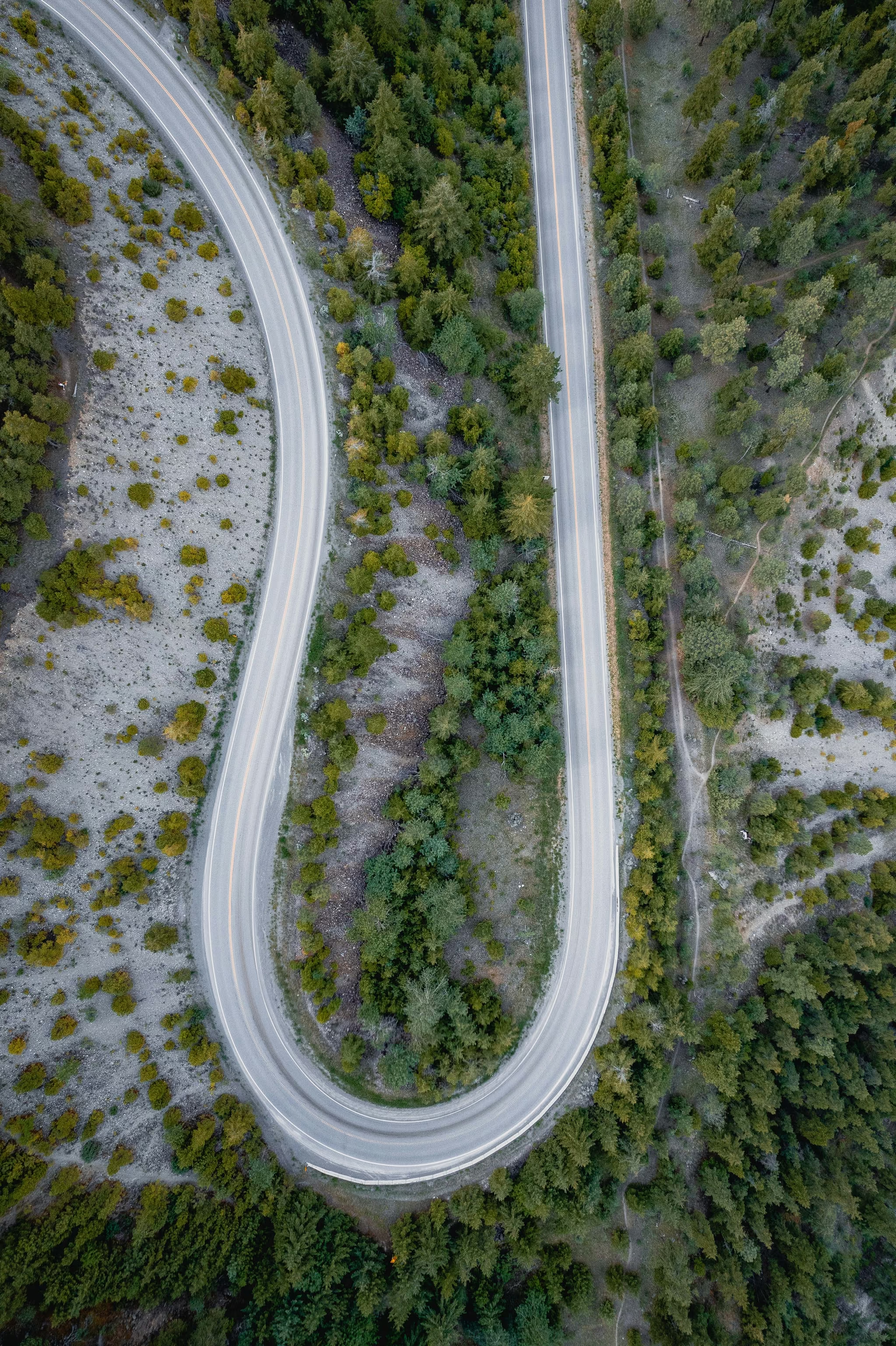
The geometry is the whole location. Foreground: the switchback, yellow lines, trees. Mid-ground: the lake. Background: the bare slopes that tell you you have left the coastal rainforest. A vertical that holds the U in the lower third is stronger than a 105mm frame that only takes the water. The water without the road could be anywhere with silt. The hairpin is Seton.
Nearby
Joffre Lakes is back west on the same road, in a different climate. Duffey Lake is another pullout. The Hope-Lillooet-Whistler loop is the trip this stop belongs to. Do not stack Joffre in winter and this lookout unless you have already decided the highway is the point of the day.
Overcast, highway dry enough to stop, lake holding colour. Photographed the hairpin from the bluff above the switchback. Duffey open. Stay out of the lane.
Reported by Parveen Singh
My BC trail kit and A7 IV settings
What is in my bag on a BC hike and why, plus the A7 IV settings I start from for each kind of scene. Confirm your email and it lands in your inbox, then one letter a month after the hike.
By signing up you agree to receive emails from psingh.ca. One letter a month, and you can unsubscribe any time.
Shooting this trail
Photography notes
- Best light
- Mid-morning to late afternoon, when the lake is in sun and goes that unlikely turquoise. 29 December was overcast and the water still read as colour, which is the honest winter version. Midday is fine here in a way it is not in a rainforest gorge, because the subject is a landform and a road, not moss. Overcast flattens the far peaks and is still worth stopping if you already drove the Duffey.
- Best season
- May through October for the postcard turquoise and a highway that is actually a highway. Late December is a different assignment: the same hairpin, a greyer lake, and a road that may be the whole risk of the day.
- Compositions
- From the bluff, 24-35mm, the hairpin as a U in the lower half, the lake as the reason, the scree slope as the dry-side tell.
- Straight down on the asphalt and the double yellow. People and trucks for scale. Without the road it is a generic mountain lake.
- The 105mm end on the far shore and the landslide scar. The hairpin stays in the foreground or you have lost Seton.
- Gear
- A polariser helps the water if there is sun. 24mm is the tool, not 105mm that only takes the lake. Do not stand in the lane for a better angle. The top-down frame on this page is from above the switchback. It is not an invitation to fly a drone over a working highway.