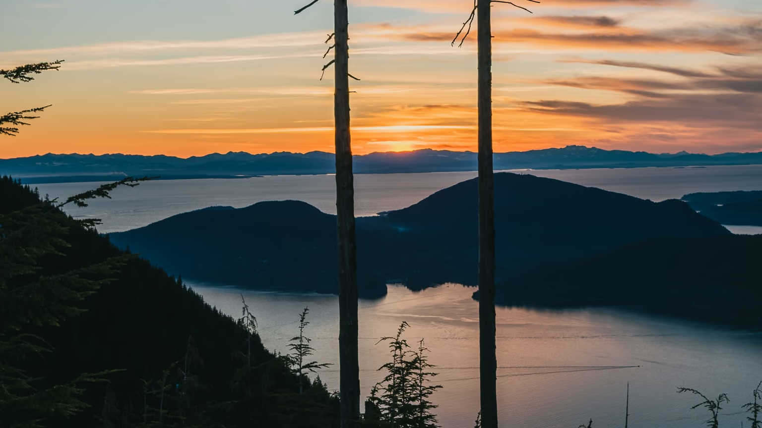
Bowen Lookout, Cypress: The Easiest Sunset Over Howe Sound
The best sunset-to-effort ratio in Cypress Provincial Park, and the one winter route out of the Cypress Bowl that a beginner can do honestly. Two hours, a hundred metres of climbing, and the sun going down over Howe Sound.
·
Quick facts
- Distance
- 4 km
- Elevation gain
- 110 m
- Highest point
- 1,030 m
- Difficulty
- Easy
- Time needed
- 1.5-2.5 hours
- Route type
- Out and back
- Season
- Year-round. Snow-covered from roughly late November to April, when it becomes the busiest beginner snowshoe route at Cypress. Snow-free hiking is usually July through October.
- Drive from Vancouver
- 45 min
- Transit accessible
- Yes
- Dog friendly
- Yes
- Pass or permit
- No pass requiredNo BC Parks day-use pass is required for Cypress. As of the 2026 season only Joffre Lakes, Garibaldi and Golden Ears require one in summer and only Mount Seymour requires one in winter. What Cypress does require, from November 1 to May 31, is a free backcountry access corridor (BAC) tag to pass through the resort ski area. Pick one up at the self-registration area in the Black Mountain Lodge and show it at the ticket-check gate. It costs nothing and takes two minutes, but you will be turned back without it.
- Last hiked
- Traditional territory
- Sḵwx̱wú7mesh Úxwumixw (Squamish), səlilwətaɬ (Tsleil-Waututh) and xʷməθkʷəy̓əm (Musqueam) territory
On this page4 sections
Bowen Lookout is the trail I send people to when they say they want to try snowshoeing and I do not want them to hate it. It is four kilometres return, about 110 metres of climbing, and it ends at a cleared west-facing bench looking over Bowen Island and Howe Sound at roughly 1,030 metres. In winter it is a wide, heavily tracked snowshoe route with a real reward at the end. In summer it is a forty-five minute walk that most people do as a warm-up before continuing to St Mark's Summit.
Doing it as its own objective, in the last two hours of daylight, is the version I like.
The route
Park in the Cypress Bowl downhill lots and walk to the north end of the pavement, past the Cypress Creek Lodge buildings. The Howe Sound Crest Trail leaves from the wooden trail-map sign near the far end of the Crazy Raven, and for the first stretch you are walking up what is essentially a ski-area service track along the edge of the runs.
That first section is the least pleasant part and it is over quickly. In winter it is also where the backcountry access corridor matters: the marked corridor with green circular signs is how you legally and safely cross the resort's terrain, and it is where the ticket-check gate wants to see your free BAC tag.
After roughly two kilometres the HSCT crosses a bench of open forest and a signed spur breaks left to the lookout, maybe 300 metres of nearly flat walking to the viewpoint itself. Take it. The main HSCT continues north toward St Mark's Summit and, eventually, the Lions.
The viewpoint is small. It is a cleared bench with a drop in front of it, not a summit, and two or three people fit comfortably at the front edge. On a February Saturday afternoon there will be a rotating queue of snowshoers taking the same photograph. Ten minutes of patience usually gets you a clear frame.
Distances people report, and why they differ
Published figures for this trail run from 4.0 to 4.2 kilometres and from 110 to about 200 metres of gain. Both ranges are honest. The trail rolls, so a GPS track that counts every small rise and drop will give you a larger cumulative number than the simple difference between the parking lot at roughly 915 metres and the lookout at roughly 1,030. Winter routes also wander: the packed track in February does not follow the summer trail exactly.
Plan for two hours and you will be right in any season. If you are moving well in summer you will do it in ninety minutes.
Winter, honestly
This is one of three maintained backcountry winter trails in Cypress Provincial Park and it is the one I would put a first-timer on. The grade is gentle, the track is almost always broken by the time you arrive, and there is a ski area within earshot for most of the route.
Two things people still get wrong.
The first is the BAC tag. From November 1 to May 31 you need one to pass through the resort area, they are free, and they live at a self-registration area in the Black Mountain Lodge. Get it before you start walking. Being sent back down to the lodge in snowshoes is a bad way to spend twenty minutes.
The second is what happens past the lookout. BC Parks strongly discourages winter travel on the Howe Sound Crest Trail past Bowen Lookout, and this is where the terrain changes character. North of here the HSCT traverses steep, open avalanche terrain above Howe Sound with no winter trail marking. Bowen Lookout is a good winter objective precisely because it is where the sensible turnaround is. Check the Avalanche Canada North Shore forecast at avalanche.ca before you go regardless, and treat the lookout as the end of the trail rather than a waypoint.
Practical notes
No day-use pass for Cypress. Only Joffre, Garibaldi and Golden Ears need one in summer and only Mount Seymour needs one in winter, so the Seymour rules people have memorised do not transfer.
Parking is free in all lots in summer. In winter BC Parks notes the resort may implement pay parking outside the free designated areas between November 1 and May 31, so check the current arrangement rather than assuming. Overnight parking is Lot 3B only. Winter tires are legally required on Cypress Bowl Road from October 1 to April 30.
Dogs are allowed and must be leashed on the Howe Sound Crest Trail and on the Bowen Lookout spur. They are not allowed on the Yew Lake trail when it is snow free, which catches people out who plan to link the two.
The boardwalk and packed sections near the start glaze over by January, and the mid-afternoon refreeze on a sunny day turns the tracked snow into something you genuinely want traction for. Snowshoes with heel lifts are overkill for the grade but the traction is not.
Drones are prohibited: operating one without permission in a BC provincial park is illegal, and permission is rarely granted.
Winter snowshoe to the lookout. Tracked path, west light on Howe Sound, rotating queue at the bench. The first section along the ski runs was the worst walking of the day.
Reported by Parveen Singh
Trail notes from the field
One email a month: what is melting out, what is snowed in, and where the light is good right now. Written after the hike, not before it.
By subscribing you agree to receive occasional emails from psingh.ca. No spam, no selling your address, unsubscribe any time.
Shooting this trail
Photography notes
- Best light
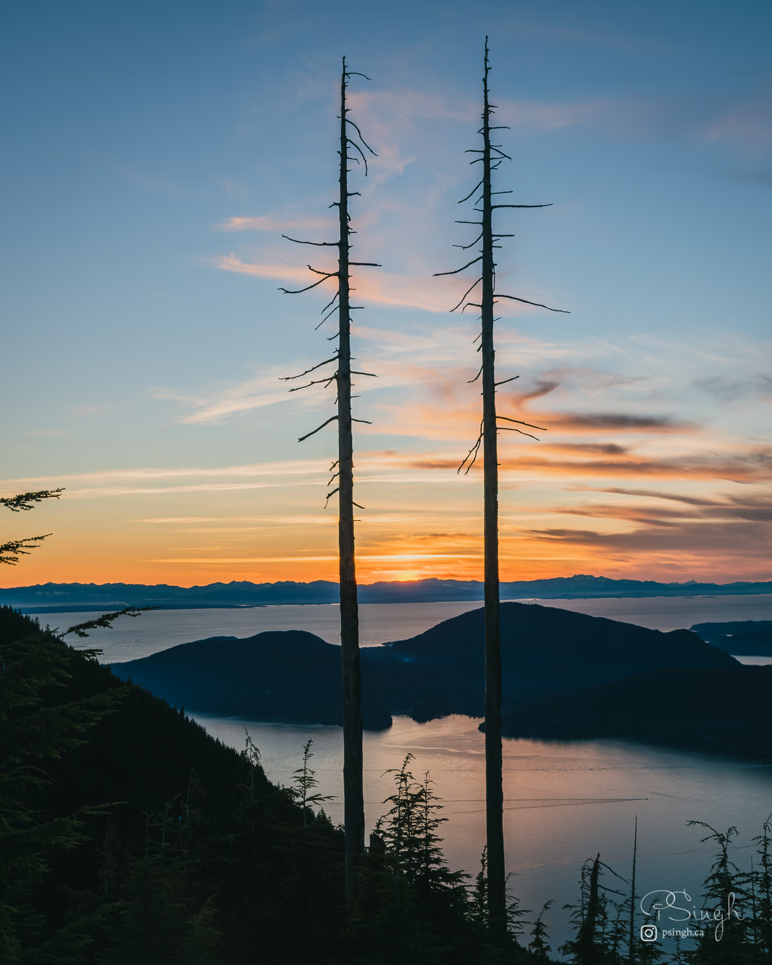
- Sunset, and this is one of the few viewpoints near Vancouver where that is not a compromise. The lookout faces roughly west over Bowen Island, so from about March to September the sun sets directly into the frame across the water. In December and January it drops further south-west behind the Sunshine Coast, which is arguably better because you get colour across a wider arc of sky. The other reason this works is arithmetic: it is a 45-minute walk out, so a blue-hour shoot costs you one headlamp descent on an easy, wide, well-tracked trail rather than an epic.
- Best season
- Two answers. November to February for early sunsets, snow-loaded hemlock and the chance of sitting above a Howe Sound cloud layer. Late August and September for warm haze and the sun setting over open water rather than over land.
- Compositions
- Bowen Island against the sun path at 35-70mm. The island sits in the middle distance with the Sunshine Coast behind it, and thirty minutes before sunset the water between them turns into a sheet of specular highlights. Expose for the highlights, let the island go dark, and you have a two-tone graphic image with no post-processing to speak of.
- Snow-loaded hemlock as a frame at 16-24mm. In winter the trees at the edge of the cleared bench carry heavy snow and make a natural aperture around the sound. Stand back from the front rail rather than at it. The best version of this needs the trees lit by the last warm light while the water behind is already cool, which is a roughly ten-minute window.
- Compression down the sound at 100-200mm. Looking north-west, the headlands of Howe Sound stack toward Gambier and Keats. This is the frame that rewards haze, and it is the reason to carry the long lens on a walk that otherwise does not justify it.
- The inversion frame. On cold, clear, high-pressure winter days the fog fills Howe Sound and the lookout at 1,030 m sits above it. Shoot at 24-35mm with fog filling the lower half and the Coast Mountains as a hard horizon. Check a Howe Sound or Horseshoe Bay webcam before you drive up.
- Gear
- A tripod is worth carrying because the walk is short and blue hour is the point. In snow, use wide feet on the legs or it will sink mid-exposure. Keep spare batteries against your body: a cold battery reads empty and comes back once warmed. There is no shelter at the lookout and it catches the wind straight off the sound, so bring a cloth for spindrift and a warm layer you would not normally take on a two-hour walk.