Sunshine Coast
Mainland BC that you can only reach by ferry - a strip of coast from Langdale to Lund carrying the Sunshine Coast Trail, Canada's longest hut-to-hut route, where every hut is free and nobody takes a reservation.
1 trail guide · 4 h 45 min from Vancouver
The Sunshine Coast is mainland British Columbia with no road to it. Getting to the upper coast means two ferries, or one ferry and a long drive, and that friction is the only reason a 180 km hut-to-hut trail through this kind of terrain is not overrun.
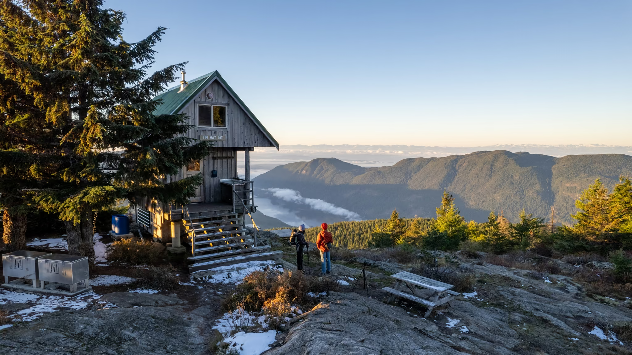
The Sunshine Coast Trail is the draw. It runs from Sarah Point to Saltery Bay, it is the longest hut-to-hut trail in Canada, and every hut on it is free and unbookable. You walk in and you take what is there. Tin Hat sits at roughly the halfway point with a pellet stove and a 360 degree view, which makes it the best value overnight in the province and also the one most likely to be occupied.
What the region is good for
Free huts. No fees, no reservations, no lottery. The tradeoff is that you carry a tent anyway, because a full hut is entirely possible and nobody is obliged to make room.
Genuine solitude. The ferry filters out casual traffic in a way that no trailhead parking lot ever does.
Long-form walking. This is one of the few places in southwest BC where you can string together days rather than planning single objectives.
Access notes
Water is the constraint people underestimate. There is none at the Tin Hat hut. You carry every drop you need for the night and the descent, which for a summer overnight is a lot more weight than the 9.2 km and 587 m of gain suggest.
Access to Tin Hat is from the south via Lang Bay rather than from Powell River directly: Dixon Road to Goat Main, then Spring Lake Main, then a pullout. These are active logging roads with the usual rules - loaded trucks have right of way, and a full-size spare is not optional.
Plan the ferries first and the hike second. Sailings are the hard constraint on any trip up here.
Seasons
| Season | Reality |
|---|---|
| May-Sep | The dry window and the practical season. Snow can still be sitting on the Tin Hat summit into early summer. |
| Oct-Nov | Quiet and wet. The huts come into their own once the weather turns, if you are prepared for short daylight. |
| Dec-Apr | Winter ascents happen but the logging road access is the limiting factor rather than the trail itself. |
Sunshine Coast trail guides
Every guide below is a trail I have personally hiked, with the date I was last there on the page.
- Sunshine Coast
Tin Hat Mountain: The Free Hut at the Middle of the Sunshine Coast Trail
The best value overnight in British Columbia - a free winterized hut with a pellet stove at the halfway point of Canada's longest hut-to-hut trail, and you carry every drop of water you will drink.
- Distance: 9.2 km
- Elevation gain: 587 m
- Difficulty: Moderate